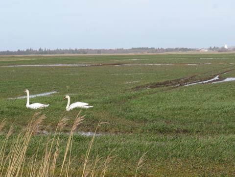
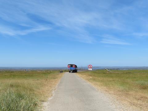
Gå til hovedindhold (Tryk Enter)

Vester Vedsted to Høm

The first stage of the Border Path starts in Vester Vedsted and ends in Høm. Most of the route takes place on tarmacked roads, with broad grassy shoulders or pavements for hikers. You can also walk a loop/ make a round trip from Vester Vedsted.

Shelters near Vester Vedsted

About the route

The first stage of the Border Path starts in Vester Vedsted and ends in Høm. Most of the route takes place on tarmacked roads, with broad grassy shoulders or pavements for hikers. One can also walk a loop/ make a round trip from Vester Vedsted.

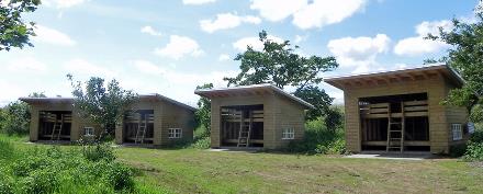
In Vester Vedsted there is a shelter next to Digehytten on Vester Bjergvej, and in Høm there is a one south of Vesterlundvej.

Nature

The first stage will take you from the wide open spaces of the marshland to the inland plantations and cultivated fields. From Ho Bay in the north to Holland in the south, the Wadden Sea is listed as World Heritage. The Høm district is marked by farming, its villages surrounded by fields and its streams surrounded by grazing-meadows.

Attractions

Experience the Wadden Sea at close hand with a visit to Vadehavscentret or by taking the tractor bus across Låningsvejen to Mandø. Crossing Låningsvejen or the Wadden Sea on foot is strongly discouraged. The high tide rises faster than one would expect.

Visit the market town of Ribe, with its many listed houses deemed worthy of preservation, or one of the town’s museums.

Local history

The Dual Town of Egebæk-Hviding

Until 1920, Egebæk-Hviding was divided between Denmark and Germany, and both contraband and refugees crossed the border in the dual town.

Read more about the dual town of Egebæk-Hviding

The Border Station in Egebæk-Hviding

Following 1864, Egebæk-Hviding was divided in two: Egebæk in Denmark and Hviding in Prussia. Also the train station was divided in two and with its 220 m platform it became Northern Europe’s longest.

Read more about the Border station in Egebæk-Hviding

Traces of the Border at Hviding

The border came to divide the dual town of Egebæk-Hviding, situated in Vester Vedsted Parish and Hviding Parish, respectively.

Read more about the Border at Hviding

Traces of the Border Period near Hviding Kirke

From 1864 to 1920, the parish of Hviding Sogn belonged to Prussia. During WWI the parish had to hand the church bell over to the German state, as it had run out of metal for the production of munitions.

Read more about Traces of the Border Period near Hviding Kirke

Memories of the Border near Vester Vedsted Kirke

The border ran close to Sprækbro south of Fløjdiget from 1864 to 1920, and the graveyard next to Vester Vedsted Kirke, which was built from 1175 - 1200 approximately, has stories to tell of world wars and cross-border conflict.

Read more about memories of the Border near Vester Vedsted Kirke

Reminders of the Border Period in and around the Churches in Roager, Spandet and Seem

Several traces of the border period can be seen in and around the churches (i.e. kirker) in Seem, Spandet and Roager. In Spandet Kirke, there is a plaque commemorating 17 Danish-minded soldiers, who were killed during WWI.

Read more about Reminders of the Border Period in and around the Churches in Roager, Spandet and Seem

Dike Construction by the Wadden Sea

The 6 meters high dike between Roborghus and Vester Vedsted was built from 1911-1915.

Read more about the Dike Construction by the Wadden Sea

A Danish-minded Boarding School in Vester Vedsted

In 1888, Germany banned all teaching in Danish. As a result, the parents sent their children to independent boarding schools for lower secondary students.

Read more about A Danish-minded Boarding School in Vester Vedsted

Bunkers and Bombers in Vester Vedsted

During WWII, the west coast of Denmark was part of the German coastal defence system known as the Atlantic Wall. The Germans built three bunkers north of Vester Vedsted in 1943, each with a telephone, machine gun and cannon.

Read more about Bunkers and Bombers in Vester Vedsted
'); }