Gå til hovedindhold (Tryk Enter)

The Border Path - A 3-stage hiking route

The Border Path is a 48 km long hiking trail that can be divided into three stages: from Vester Vedsted to Høm, from Høm to Obbekær and from Obbekær to the Kongeå. In several places you can make a roundtrip as well as spend the night in shelters. 

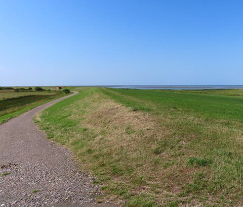
Following its defeat by Prussia in 1864, Denmark lost a third of its acreage. Sothern Jutland became German and the new border ran south of Kolding, along Kongeåen (i.e. the Kongeå river), to continue south of Ribe. Grænsestien (i.e. the Border Path) follows this border from the Danish Wadden Sea to Kongeåen. Along the way, you can hear stories of gendarmes, illegal immigrants, customs inspectors, smugglers and Danish-minded citizens from Southern Jutland who served in the German war effort.

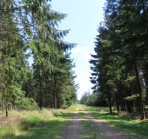
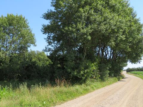
The hiking route is divided in three stages: From Vester Vedsted to Høm, from Høm to Obbekær and from Obbekær to Kongeåen. As you walk, you will meet tarmacked roads, trails and forest paths. Along the way, there are several places where you can make a round trip looping back to your starting point, and there are shelters where you can spend the night. Dogs must be kept on a leash.                                                                                   

Along the way, you can expand your route by following other hiking and bicycle routes:

1. Vester Vedsted to Høm

The first stage of the Border Path starts in Vester Vedsted and ends in Høm. Most of the route takes place on tarmacked roads, with broad grassy shoulders or pavements for hikers. One can also walk a loop/ make a round trip from Vester Vedsted.

In Vester Vedsted there is a shelter next to Digehytten on Vester Bjergvej, and in Høm there is a one south of Vesterlundvej.

The first stage will take you from the wide open spaces of the marshland to the inland plantations and cultivated fields. From Ho Bay in the north to Holland in the south, the Wadden Sea is listed as World Heritage. The Høm district is marked by farming, its villages surrounded by fields and its streams surrounded by grazing-meadows.

Experience the Wadden Sea at close hand with a visit to Vadehavscentret or by taking the tractor bus across Låningsvejen to Mandø. Crossing Låningsvejen or the Wadden Sea on foot is strongly discouraged. The high tide rises faster than one would expect.

Visit the market town of Ribe, with its many listed houses deemed worthy of preservation, or one of the town’s museums.

2. Høm to Obbekær

The second stage of the Border Path starts in Høm and ends in Obbekær. Between Høm and Obbekær, one can either walk around, or through, Stensbæk Plantage (i.e. plantation). The surface varies between tarmacked roads with broad grassy shoulders and forest paths. There are shelters in Høm and in Stensbæk Plantage, and a campsite next to Enderupskov (i.e. forest).

The route passes through an Ice Age landscape with steep slopes and deep river valleys, through forests and across moors, all of which are rich in animal and plant life.

Munkesø (i.e. lake) was drained in the 1860s to create meadows for the cultivation of hay. However, it was restored in the 1930s and covers 24 ha.

Stensbæk Plantage covers over 2000 hectares of natural environments comprising a number of plantations, marshes, streams and moors near Varming, Stavnager, Enderupskov and Gelsbro.

The German state commenced the planting of the plantations in 1904.

Ribe Golf Club is open for guests. Both Obbekær Kirke and Hygum Hjemstavnsgård (i.e. home farm) stand as monuments of the border period.

3. Obbekær to Villebøl

The third stage of the Border Path starts in Obbekær. From here, it more or less follows the line of demarcation of the 1864-1920 Border between Denmark and Germany. You can overnight in Stensbæk Plantage or at the campsite on the banks of Kongeåen. The route consists of tarmacked roads with broad grassy shoulders and trails, along with field and forest boundaries.

Hjortvad Krat consists of old forest and heather moors. While currently cultivated, the area used to be a moor called Fæsted Hede. Situated on a ridge, Horslund Krat’s oak thicket has developed over the years into an oak forest. There are several listed burial mounds in the area.

Along the way you can visit Kalvslund Kirke. The parish was divided in two following 1864. While Kalvslund went to Denmark, Ravning and Bavngård went to the German parish of Sdr. Hygum Sogn.

Danish customs offices were located in a number of places: housed in a mill, Kalvslund Mølle, in two inns, Kalvslund Kro and Villebøl Kro (currently Kongeå Camping), and in Blokager farm. The German customs office was initially housed in Kalvslund Kro. From here, it was quite rapidly moved to Koldingvej 68 in May 1865.

Along Kongeåen there is an intersection with another hiking route, i.e. Kongeåstien. One can also go canoeing from here.

Connections to other pathways

Along the Border Path you can continue the hike on other hiking or cycling trails. View the map and read more about other pathways.