Border town
Egebaek-Hviding was formerly called Vedsted and was divided into two until 1920 with a barrier between Denmark and Germany blocking the main street.
There were customs buildings on either side of the border in the dual town. North of the border Dannebrog (the Danish flag) was hoisted and to the south the German Imperial Flag in black, white and red which was Germany's official flag from 1871 to 1919.
The two customs stations were mirror images of each other and were adjacent to the railway station. The railway station was divided into a Danish and a German section, and highway 11, now daily traversed by Danes and Germans from the north and south, was blocked by a bomb.
The customs stations included both offices and accommodation for the customs officers.

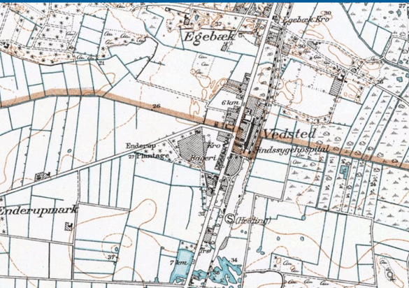
This map from the first half of the 20th century shows the division of Egebaek-Hviding. The border ran through the middle of the town and turned a little south around the train station which was divided into a Danish and a German half. The town was then called Vedsted but later changed its name when the villages of Egebaek and Hviding grew together. Source:Geodatastyrelsen
